This would be my second “big” trip, but I’ll always think of it as the first step towards a deep love of Adventure Touring. A friend of mine mentioned that he was going to ride to Prudhoe Bay in Alaska. I asked him if I could come along before I could even look at a map to see where Prudhoe Bay was. He agreed to my company and I went out and bought a 1995 Kawasaki KLR 650 and proceeded to “kit it out” with new fork springs, skid plate, windscreen, tank panniers, and fork brace. But I didn’t have much confidence in the electrical system and even though I thought I might have fixed it, mere weeks before the of departure I bought a 2000 model. I switched over all of the upgrades and was ready to go with days to spare. My riding partner and I had researched the route, the weather and our provisions and felt that we were ready. Here is the story of our journey into the unknown.
July 23rd – August 8th, 2004
Total Miles: 5,600 miles, 17 days
White Rock, BC – Deadhorse, AK and return
Day .5 – 100 miles
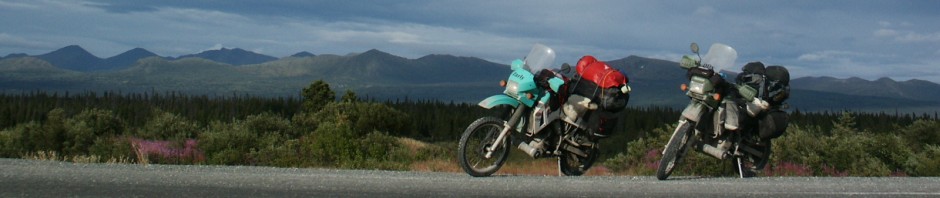
The odometer on the KLR had just rolled over 10,000 when I left Seattle this evening and the 100 or so miles I put on between then and now were just the start. My riding partner, Doug, and I agreed to meet in White Rock, BC to start our epic journey northward, to the Arctic Ocean. We had been talking about and planning this trip for almost a year. We looked at maps, mileage, bikes, routes, equipment, supplies and money. Amazingly enough, it was about to begin.
Day 1 – 480 miles
We had a wonderful meal at a nearby restaurant and spent the night at a small motel in White Rock, BC. The helpful woman at the motel desk in White Rock suggested that if we wanted to avoid the Vancouver traffic on Friday morning then we should leave by 6am. The alarm went off as it was supposed to do and we packed up the bikes and took off east to Hope, BC. This is a rather dull stretch of road, and at this hour there wasn’t much going on. We had a quick bite to eat at Hope before heading north up the Frasier River Canyon (#1). This is a beautiful stretch of road and includes some excellent scenery along the Frasier River, through Hell’s Gate Air tram base and then on to the more arid and warmer climates of Ashcroft and Cache Creek. Once we left Cache Creek we had reached a point where neither of us had been this far north before. At Cache Creek the road becomes the #97 and the landscape flattens out from a spectacular river gorge to more mundane hills, farms and forests. At Williams Lake we decided that after the heat and the early start to the day we deserved a rest. We found a not-so-quiet spot near the lake underneath a large tree and attempted to nap. Unfortunately, the gleeful children playing in the water, the crows calling out to each other and the chain smoker at a nearby table all conspired to keep us from complete rest. However, it was still an appreciated stop (even though our chap stick melted in our tank bags – it was hot!). We pulled into Prince George and found a motel less than a block away from Moxie’s, a tasty “classic” grill. I’m not sure what “classic” is supposed to mean, but they have a damn fine Honey Roasted Garlic Sirloin that really hit the spot!

Packing up the bikes for our departure

An explosion of gear in the hotel room
Day 2 – 435 miles
As would be typical for the trip, we didn’t leave Prince George until almost 9:30. We’re on vacation, darn it, and we’re going to sleep in if we want! However, we didn’t get started on the road right away even after leaving the motel. It seems that the muffler/heat guards that a friend of mine made for our bikes didn’t quite do the trick and the plastic bag Doug used to line his saddlebag with melted onto some of his clothes. We need more insulation, and we need it now. Fortunately we’re still in the hands of civilization and we found a Home Depot nearby. What to get, what to get??? We scoured the aisles and found some pipe insulation that was actually something like two sheets of aluminum foil with bubble wrap in between. Can’t hurt, right? So we bought a roll, cut and tape it together to create a lovely insulating wall inside of Doug’s right saddlebag. Tools and gear repacked, we proceeded westerly on the Yellowhead Hwy. Now begins our journey into the unknown!
The Yellowhead winds through lots of agricultural lands with frequent little towns dotting the way. The mountains got bigger and the trees got thicker. The temperature was comfortable, the sky was mostly blue, the roads were in good repair and traffic was not a problem. It was a great start to our trip. Breakfast was found at the OK Café in Vanderhoof, served by Mennonites of all people. We made a couple of stops along the way at Topley and New Hazelton for refreshments and brief breaks, in addition to a few photo stops. At Topley Doug found that part of his helmet was missing. It’s a little part that holds the visor on and is fairly vital. The first zip tie of the trip is called up for duty.

Home Depot – for all of your motorcycling needs

Taking a break in Topley

Along the Yellowhead, heading for Smithers

Stopping for a bite to eat in New Hazelton

Getting closer to Smithers!

Riverside photo stop
At Smithers, BC, we met a gentleman who strongly encouraged us to make the side trip to Stewart, BC and then cross over to Hyder, AK to see where the grizzly bears feed on the salmon. It sounded good, so we made reservations at the Rainey Creek Campground in Stewart. The name should have warned us, but we were naive. The ride up #37 from the Yellowhead junction near Kitwanga was peaceful, with very little vehicle traffic. We saw our first black bear (there would be six seen on this day alone) as well as a beaver and a marmot. Once we took the turnoff to Stewart the scenery became more intense. The mountains reared up in front of us like the teeth of a bear. Glaciers and snow-covered peaks played hide-and-seek with the clouds and the sun was slowly sinking to the far northwest. Rivers rushed past us with their cold water frothing over rocks that had tumbled down the mountainsides. It was a beautiful ride.
Once in Stewart we had dinner at a Chinese restaurant and then reconsidered camping and looked into the availability of a motel room. We were shocked by the price and tucked our tails between our legs to go set up camp. In the rain. And the almost-dark. Surrounded by mosquitoes.

Smithers!

Along the Stewart Cassiar

Empty roads and beautiful scenery

Along the turnoff to Stewart

Mountains and glaciers

Bear Glacier

Bear Glacier

Setting up the tent in Rainey Creek Campground
Day 3 – 451 miles
We woke up at 5am with really cold rainwater dripping on us from a leaking tent. Our sleeping bags were wet. Our gear was wet. We were wet. We got up, dragged everything over to a covered picnic shelter and in the cold, cloud-covered morning light we stuffed all of our soaking stuff into bags and tied them back on the bikes. Alas, we couldn’t leave town just yet: the gas station didn’t open for another hour. And the café wouldn’t open for another 10 minutes, but we let ourselves in any way and had a seat in the relative warmth. After a leisurely and tasty breakfast we rode over to the gas station, filled up the bikes and then rode a very wet ride back through the not-so-spectacular mountains that couldn’t be seen.
We rejoined the Stewart-Cassiar Hwy at Meziadin Junction and headed north, into progressively better weather, although it never truly warmed up. There isn’t much in the way of civilization until you get to Iskut, and even that is a just a tiny little store by the side of the road. We stopped – unfortunately – at Dease Lake for lunch. Icky, no-character place with a server who repeatedly hacked over her order pad and the food. Yuck. Come to think of it, I didn’t eat there, but Doug had some pie. Somewhere along there is Bell II (not sure if that’s a “2” or an “11”; Doug says “11”). It’s a really nice and expensive looking place. Apparently their clientele are those insane people who require a helicopter to get to the glaciers and snow fields in order to ski. Regardless, it’s a nice place with friendly people.

Stewart-Cassair Highway

Stewart-Cassair Highway

Bell II

Bell II
We had been warned about the road conditions along this highway; that there was lots of construction and stretches of gravel, and we were not disappointed. The gravel sections were well-marked and easy to anticipate. They were generally fairly well-packed, although I can see that a good rain would easily make it a quagmire. The gravel sections were varied in their length and placement, never knowing if the next corner would be solid or not, nor how long it would go on. There was one stretch of construction that was particularly unpleasant. It stretched for over 10 miles and was all loose and thick gravel. This was quite treacherous as the gravel can grab your front tire and pull you over if you’re not careful. Not to mention the fact that it was raining again.
There were a couple more black bear sightings that day, as well as some horses along the side of the road. It was one of those “Watch for Livestock” areas, and unfortunately someone wasn’t watching, as we saw two dead horses a couple of miles later. It’s odd how you get used to seeing road kill deer or rabbits, but a horse? That really threw me off.

Along the Stewart-Cassair Highway

Doug takes a picture of me

Wet, deep and loose – ten miles of construction hell

Moose tracks!

Along the highway

Stewart-Cassair Highway

My bike, somewhere under all that gear
At the northern end of the Stewart-Cassiar highway is the Alaska Highway. We stopped briefly at this junction and then headed west along the Alaska Highway, following its gentle curves and studying the vastness of the surrounding forests. We ended the day at Walker’s Continental Divide Motel in Swift River, BC and none too early. It had been a long day, starting with a wet tent and then nothing but roads that required our constant concentration. The motel at Walker’s was an ATCO building, something that Doug and I had scorned not more than a couple of hours earlier at Junction 37, but it was heavenly! Warm, comfy, quiet, hot showers and available! As a bonus, even though the kitchen was “closed”, they still managed to rustle up some homemade soup and grilled cheese sandwiches (on homemade bread) – it was to die for!

Crossing into the Yukon on the Stewart-Cassiar Highway

My plate had fallen off along the way

Junction of the Alcan and the Stewart-Cassiar

On the Alcan!

Along the Alcan

Walker’s Continental Divide has warm rooms and good food
Day 4 – 300 miles
A breakfast just as tasty as the previous evening’s dinner set us on our way from Walker’s and on our way along the Alaska Highway. The weather cooperated and was about 68 degrees and mostly sunny. I am still amazed at the number of trees that Northern BC/Yukon/Alaska have! They stretch as far as the eye can see, and with no people populations to interrupt their command of the hills and mountains. I have to admit that I’m very disappointed to see the extensive “re-engineering” that they’re doing to the Alaskan Highway. There are literally dozens of places where you can see where the road used to go, but in the interest of safety (or whatever) they have since moved the road so as to maintain a more level, straight and therefore dull route. Doug and I took the time to follow a bit of the old highway through the woods on our return trip, which was really fascinating. If we had more time on this trip I think that I would have liked to have followed more of it. The road crew had chewed up the road surface to allow for a faster naturalization, but you could still see chunks of asphalt scattered around. Sigh. They’re ruining a perfectly good road – go ride it now while it’s still remotely interesting!!!
We saw our first moose of the trip; a timid cow munching away in a river down below the highway. She must have been camera-shy because even though we were quite a distance from her she started to move away, so we left her alone.

Moose!!!

Along the Alcan

Bridge at Teslin

On the shores of Teslin Lake
There was a nice stop at Whitehorse, YK, which is a place that both Doug and I really liked. It’s a clean bustling town with lots of nice shops and businesses. The motorcycle dealership doesn’t stock anything for the KLR though, and it’s a 3 day wait for shipments. I guess if you were to live here you’d be better off just have a parts bike sitting around.
After Whitehorse Doug and I continued west through Haines Junction where we had a surprisingly tasty dinner at the Kluane Park Inn. The mountains became larger and more snow-covered and the fields were filled with fireweed, named so because it is the first thing to take root after a forest fire wipes out an area (or any other disturbance of the vegetation).
At Kluane Lake the highway becomes more like a rural two-lane road that I would expect to see around the Pacific Northwest. It followed the shore of the lake closely and had some fun corners and dips. Eventually the road straightened out again and Doug and I decided to stop at Destruction Bay for the evening. It was a nice enough place, but not terribly remarkable. It did, however, have the three requirements: food, bed and gas. It also had some cool stickers that I’m going to put on my bike.

Straight roads

Along the Alcan

Haines Junction – good food here!

Haines Junction

Views near Haines Jct

Views near Haines Jct
Day 5 – 480 miles
After a rather uncomfortable night’s sleep (for me) we got up, had a bite to eat and headed for the Alaska border. The weather had turned on us again and had become cloudy and cool. We ran in to a lot of construction, which in the Yukon means miles of gravel and either mud or dust, depending on the weather. It also means flinging rocks from passing vehicles. Doug’s headlight cover was soundly cracked by a rock tossed up by a car we were passing; not a pretty sight. I recall saying “ouch!” a few times as rocks smacked my legs, or being thankful that I was wearing a full faced helmet as they pummeled my head and visor. My headlight guard eventually cracked as well. The clear guards were a worthy investment!
We did see two white swans in a small lake, and a moose cow and calf crossed the road in front of us, but there wasn’t much activity in the wild life department that day. I can’t say that I blame them; I was glad to get to Beaver Creek, YK and have a good hot meal. The Alaska border isn’t too far from Beaver Creek and we reached it in no time. Doug and I pulled up together (no line – surprise!) and the patrol officer looked like he was ready to exhibit all of the Power of the Border Patrol Rightfully Bestowed Upon Him. He immediately motioned for us to take our helmets off and produce our papers. As we were complying another patrol officer came out and said “Hey John – you’ve got a phone call”. “John” looked at Doug and I, then at the phone and you could see that he was deeply disappointed. He took the phone and retreated to his booth. The new patrol officer looked at our papers, asked a couple of basic questions, then asked what our destination was. When Doug said that we hoped to ride to Prudhoe Bay, the officer smiled and replied “You’re sick”. He then mused about a Canadian and an American traveling together and asked “What’s your association?” Doug said that we were friends – I think that the border patrol doesn’t see a lot of mixed country traveling companions and it caught him off guard. I thought it was funny.
The border itself is interesting in the fact that they mowed a wide swath of forest for the entire length of it.

Alaska/Yukon border

Crossing into Alaska

Bikes just past the border

Views just past the border

Views just past the border

Views just past the border
The road was fairly interesting for the first hour or two into Alaska, with wide sweeping vistas and far distant mountains. I enjoyed the numerous streams and watching the trees and vegetation change with the increased distance we were heading north.
Unfortunately, the road once again straightened out and the views became less spectacular the more miles we covered. We stopped in Tok, AK for a short break and then continued on to Fairbanks. We apparently made a bad judgment call here. We both figured that with Fairbanks being a town of over 30,000 people that there would be plenty of choices in places to stay. This wasn’t so. Even on a Tuesday night we found motel after motel booked. We did find one place, but they wanted so much money for the room (sans bathroom) that we passed. We finally got desperate and took a room at the Klondike Inn. It was expensive, and to give you an idea of what kind of place it was, Pizza Hut wouldn’t deliver after 11pm (and it was, indeed, after 11pm). We called Dominos, who brought us hot pizza shortly after.

Stopping for fudge in Tok

Bridge over the Gertsle River

The Gertsle River

Checking out the Gertsle River

The Gertsle River

Our hotel in Fairbanks
Day 6 – 0 miles
We had decided to remain in Fairbanks the next day. The goal was to find a nicer place to stay, a place to leave some of our gear while we trek north, find some rear tires to put on the bikes when we got back and pick up some last minute supplies. We called around and found what we thought was a really nice Bed & Breakfast. The thought was that a B&B would be more likely to store our gear for a few days while we went traipsing through the northern country. The problem with this B&B was that it was truly a business, not some cute and charming home that someone has opened up to visitors. Oh well, I digress… We ran our errands and took no pictures.
Day 7 – 260 miles
Of course it’s raining for the beginning of our big journey to the Arctic. We had breakfast at the B&B and pack our minimal bags onto the KLRs. It’s rather urban (well, for Alaska) through Fox and up to the beginning of the Elliot Highway. The Elliot Highway, I was to find out later, is a wonderfully fun road! But this morning it was miserable. It was raining, heavy fog and cool. I seriously started asking myself why I was doing this, and considering going back to Fairbanks. I figured that I could see other parts of Alaska and the Yukon. But I stuck it out, following Doug through the clouds for a while longer. Then we were rewarded.
The roads started to dry up a bit, and the clouds weren’t quite as thick as previously. We came to the junction where the Elliot Highway continues west and the Dalton Highway starts north. The road sign says “ALL VEHICLES DRIVE WITH LIGHTS ON NEXT 425 MILES” That’s a lot of miles.
The Dalton Highway is also known as the Haul road, as it is and was the primary way of getting supplies in and out of the Prudhoe Bay area. It was built to bring materials and workers in who were building the Alaska Pipeline and it follows the pipeline closely for its 425 miles.
The road conditions on the Dalton Highway are about as varied as the views. We started out the first few miles in a quagmire of muck inches thick that grabbed our tires and pulled our bikes willy-nilly along the road. Doug and I stopped and looked at each other, the thought of 425 miles of this a daunting challenge indeed! But we kept on going and soon found the road drying out a bit more, so that we were able to practically fly down the hard packed dirt/gravel surface.
We ran into light rain occasionally, which was a mix blessing as while it made the roads a little trickier, it also kept the dust down from the semis that barreled down the road towards us. Most of them moved over considerably and some of them slowed down. Doug and I would also slow down and move over as far as possible to give them as much room on the narrow road. There are a surprising number of trucks on this road!
We saw two lynx on our way up the Dalton. It was very exciting – they crossed the road right in front of us and even paused to give us a baleful eye that only a cat can muster. Of course they were also too quick to hang around for photos, so you’ll have to take my word for it.
We were surprised to find gas, food and lodging just past the Yukon River, as The Milepost (a Godsend of a book to have for a trip like this!) stated that there was no gas until Coldfoot. I found out later that this stop isn’t always “open” and therefore not a reliable source. We filled up “just in case” even though we each were toting 2 extra gallons on the backs of our bikes. Mind you, we paid for this peace of mind with the most expensive gas I had ever seen: $2.99/gallon for 87 octane. We had a hot sandwich and soup here before heading on to Coldfoot and then Wiseman, where we had made arrangements to stay for the night.
We stopped at the obligatory sign for the Arctic Circle, but were chased away quickly (by our own choice) by a busload of tourists. I can’t imagine how cheated I’d feel if someone else drove me to the Arctic. This is something that’s best experienced on your own, of your own doing and your own determination and will.
Just as we were approaching Coldfoot it started to rain hard, but luckily for us we were on one of those rare stretches of pavement that someone snuck in and the water poured over the pavement instead of creating a mud bath. We stopped at the Visitor’s Information center just outside of Coldfoot and looked around. There were souviners for sale and some helpful people behind the counter to answer questions. We spoke with one of them, Heidi, who happened to own a lodge just up the road in Wiseman. She was friendly enough and since we didn’t have any plans already made to stay in Coldfoot, we agreed to go to The Boreal Lodge.
Coldfoot, and all “towns” after Fairbanks, is nothing more than a building or two that houses those all-important three basics: food, shelter and gas. Coldfoot was unimpressive in its appearance, but it served hot food and had gas readily available. There was also the impressive-sounding “Slate Creek Inn” which was nothing more than an ancient ATCO building stuck in a field across from the gravel parking lot. Fortunately for us, our sleeping arrangements were taken care of 13 miles up the road in Wiseman, AK, which is an actual town from the gold mining days. The town is much more than anything else I had seen along the Dalton and actually contained real log cabins dating from a hundred years ago. It appears that quite a few people live here, making due with what they can find, and in the case of our host and hostess, lodging people for the night. The Boreal Lodge is made from ATCO buildings, but the owners did a fine job of hiding that fact and even provided a “common area” where a clean and modern kitchen/sitting area was available for all guests. Pots, pans, dishes, utensils, coffee maker (and coffee!) were all provided for guests’ use. Of course the only caveat is that there are no food stores after Fairbanks, so you have to be prepared. We weren’t, which is why we ate in Coldfoot. It was another restful night’s sleep.

North of Fairbanks

The end of the pavement

The Haul Road snaking off into the distance

The Haul Road and the Pipeline

Near Finger Mountain

Finger Mountain

View from Finger Mountain

Crossing the Arctic Circle

Views north of the Arctic Circle

Views north of the Arctic Circle

Views north of the Arctic Circle

The Haul Road in good weather

Getting closer to the Brooks Range

Fisherman in the river

Our habitation for the night in Wiseman

Individual rooms and a common room
Day 8 – 240 miles
The day’s journey would be relatively short – just long enough to not make it there and back in one day and just short enough to allow for a lazy morning. We packed the bikes up again and headed north. The weather was cooperating for the moment – so fickle – and gave us sunny skies so that we could appreciate the passage through the Brooks Range and our approach to the end of the road: Deadhorse, AK.
The geology was amazing to see: entire mountains thrust up at impossible angles and layers of erosion that have taken their toll. The rivers coursed through the valleys and the grasses smoothed out the edges of the hard stone. The Dalton Highway is fairly level for a good distance, but then climbs quickly up the south slope of the Brooks Range. The Haul road crests the Brooks Range at Atigun Pass, which was a dirty, muddy, gravely mess – and we hadn’t even hit the construction zone yet. It’s a steep, narrow pass and I’m glad to say that we didn’t meet any semis coming down while we were coming up. Descending the north side there was construction, with speeds limited to 10 mph. My bike can’t even go that slow, so we just coasted down as best as we could without attracting attention to ourselves. It was muddy (really muddy; the kind of mud we encountered when we first started on the Dalton Highway the previous day) so I was in no hurry to come down the other side of the Pass anyway.
The mountains in the Brooks Range are amazing; I have never seen anything like them before. They are massive, closely packed together and look like they were just created last week. And they go forever. I’m used to mountain passes where you say “ooo” and “awwww” for ten minutes and then you’re back in the foothills. Not here. These mountains went on for hours. Absolutely amazing. It’s things like this that come to mind when people ask “How was your trip?” It’s something that I can tell them about, but it’s never anything that they’ll understand unless they see it for themselves.
Eventually the mountains started to move off into the distance and the space between them grew. The lowlands held bogs and marshes and grasses as far as the eye could see. It took a long time, but eventually we left the mountain range behind completely and we were surrounded by … flatness. I almost felt like I was in Nebraska. Well, not really.
Finally, after about five hours of riding we arrived in Deadhorse, Alaska: the end of the Dalton Highway and as far as north you can ride in the United States (and all of North America, I believe). We had reserved an outrageously expensive room in the not-so-elegant Arctic Caribou Inn and still had the privilege of paying for dinner on top of that. I will confess that it was a very good dinner, an all-you-care-to-eat buffet, so I could have really taken advantage of that if I had the appetite.

Starting out from Wiseman

Fascinating geology

Views

Looking back along the Brooks Range

Views

Truck traffic on the Haul Road

Going over the Brooks Range

Taking a break after crossing Atigun Pass

Views after the pass

Tundra forever

More tundra

More tundra

Our first view of snow

Doug stops to wipe off some of the mud

Stellar views along the way

Our destination in Prudhoe Bay
Great ride report!!